Free summary
Free
For every house you look at
- Every hazard and planning rule, explained
- Hazard map on an aerial photo
- The zone and what you could build
- School zones and the open home checklist
A designed PDF report on a house on your shortlist, checked by a person and emailed within 24 hours. $29, one-off.
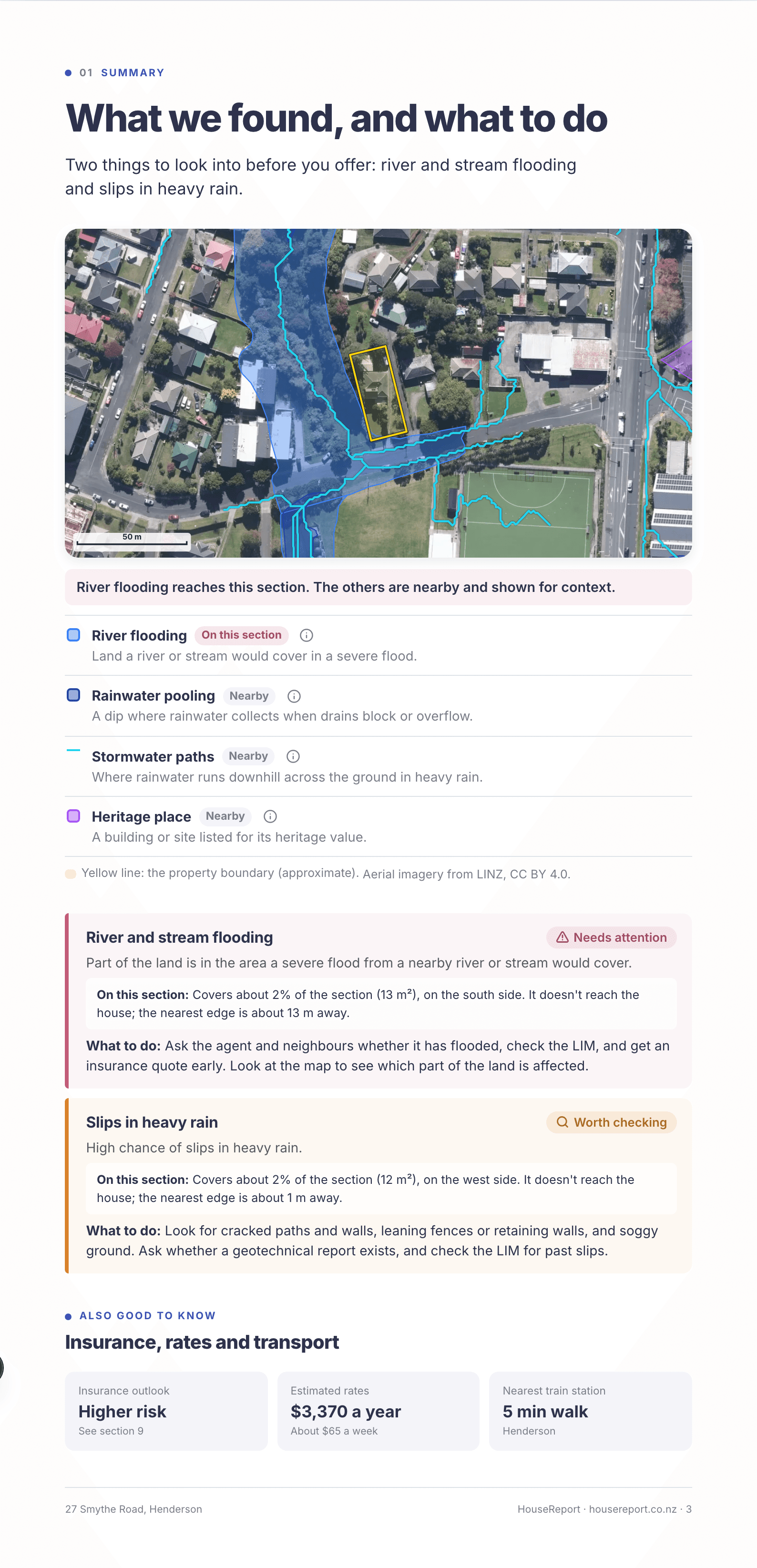
An aerial photo with every hazard and planning area drawn on it, then each thing that needs attention, how it sits on this section, and what to do.
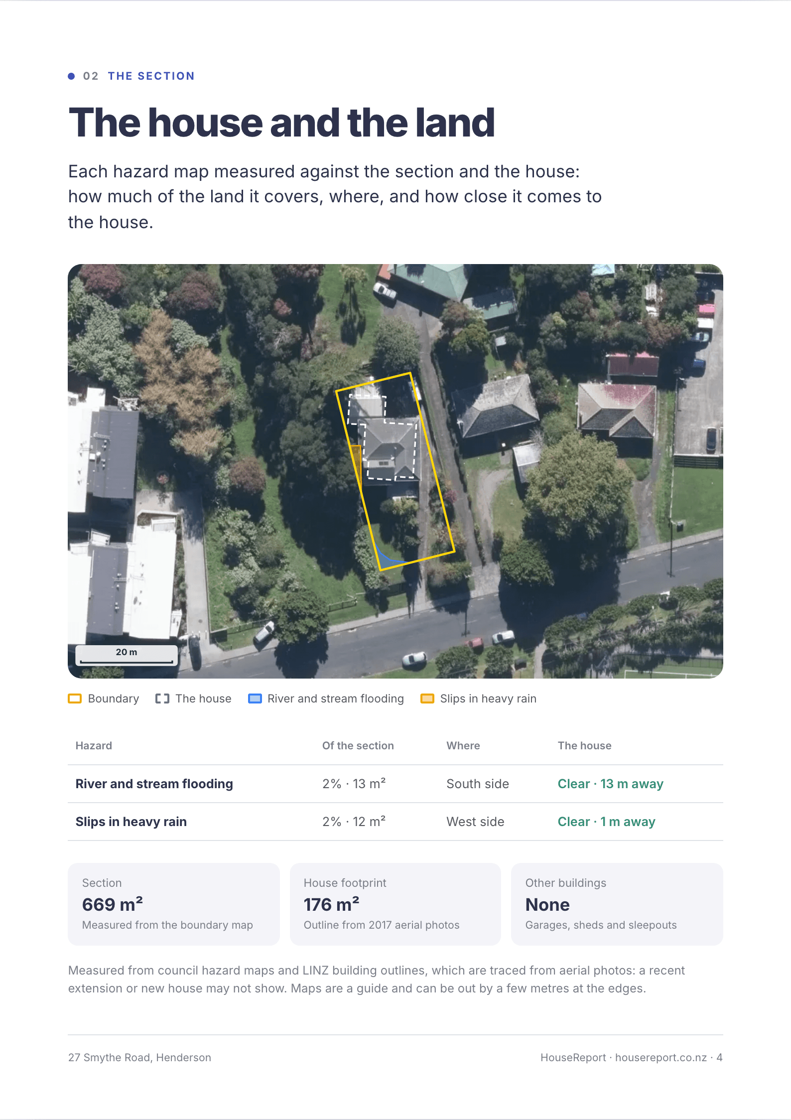
Each flood, flow path and slip map measured against the section and the house itself: how much of the land it covers, which side it is on, and how close it comes to the house.
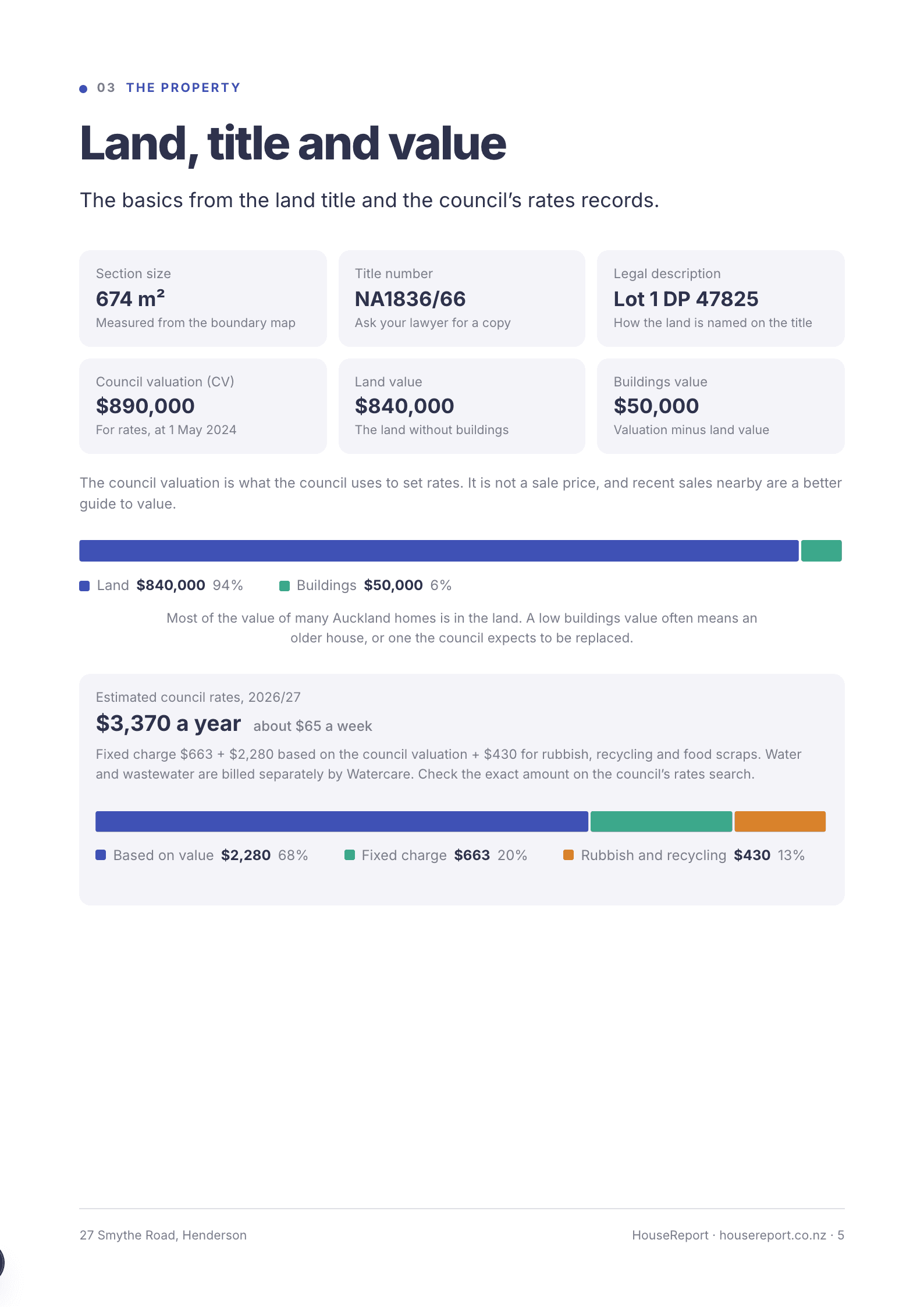
Section size, title details, the council valuation split into land and buildings, an estimate of yearly rates, and how high the zone lets you and your neighbours build.
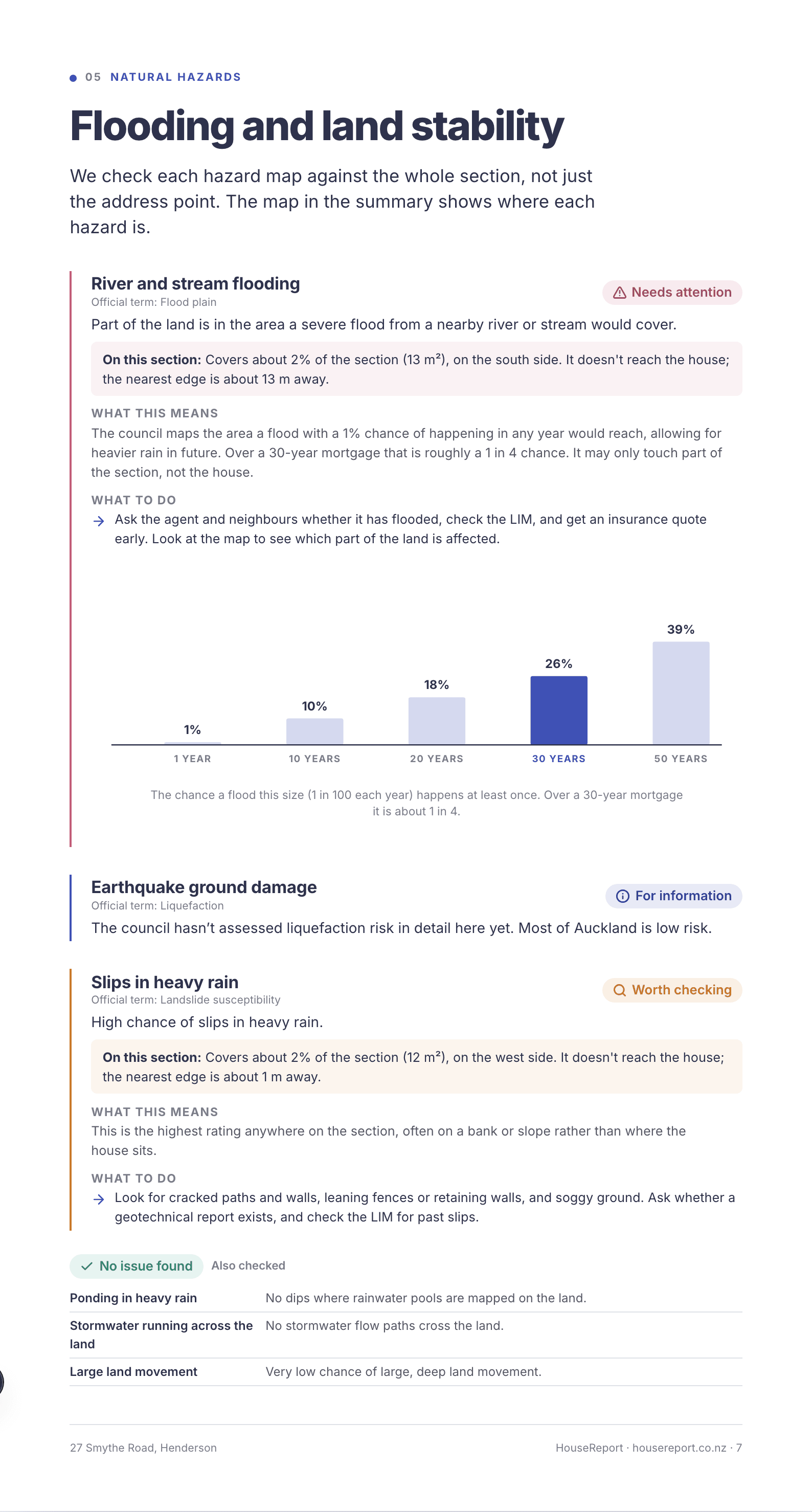
Each hazard and planning rule, with charts for the chance of a flood over a mortgage and sea-level rise to 2130.
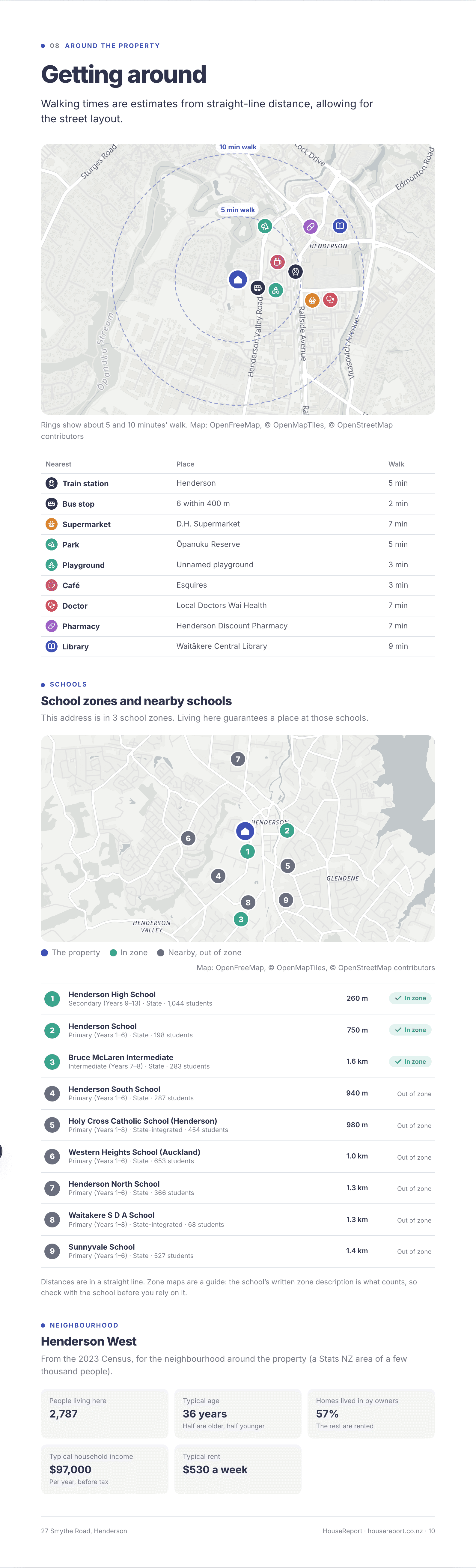
A walking map with 5 and 10 minute rings, the nearest station, shops, parks and doctors, school zones, and facts about the neighbourhood.
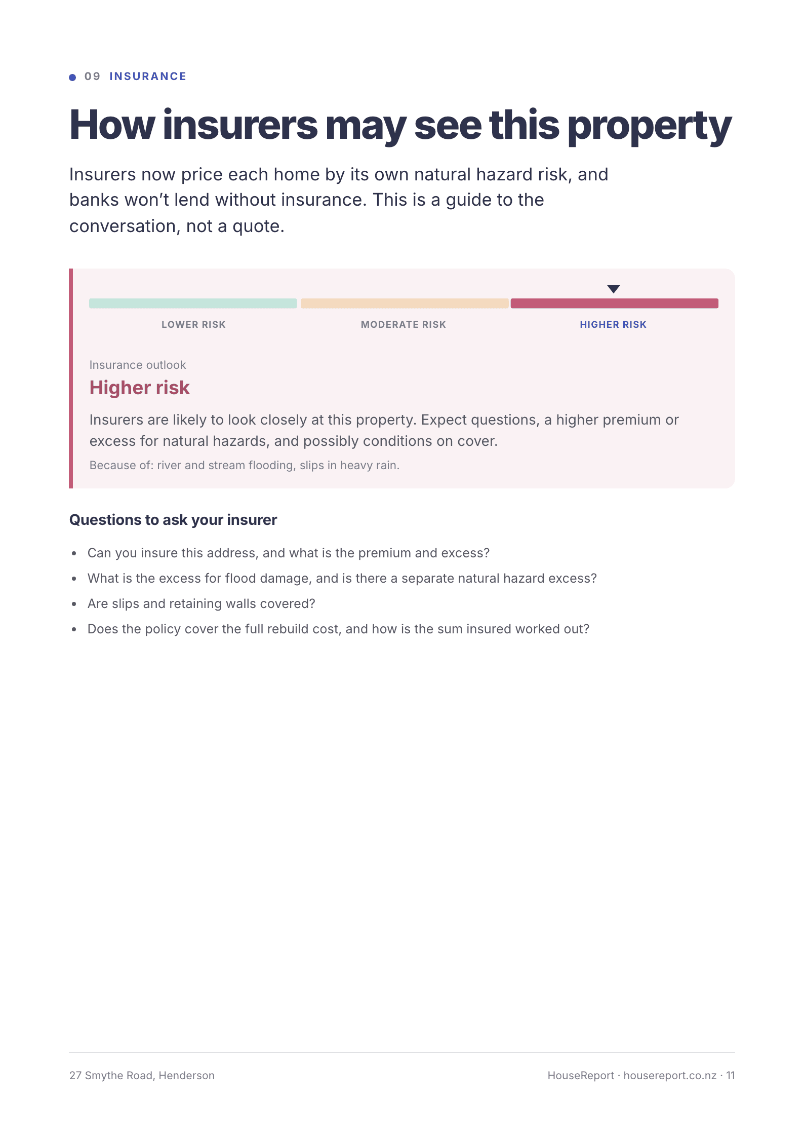
How insurers are likely to see the property and what to ask them, plus every question for the agent, starting with ones this property’s findings raise.
Free
For every house you look at
$29 NZD, one-off
For the houses on your shortlist